If you travel 70km along the Squamish River northwest of Squamish, BC, Canada, and then briefly along the Elaho River, you’ll find a smaller, rougher forest service road called the E300. Roughly 10km and 900m in elevation gain up this active logging road you’ll reach its end (as of September, 2021) and the start of the Blanca Lake trailhead.
GPX file for full drive (Squamish to Trailhead / Trailhead to Squamish (plus tiny side trip to Maude Frickert Falls))
GPX file for full hike to lake, there and back (just the lake, no Blanca Peak).
Hiking Route
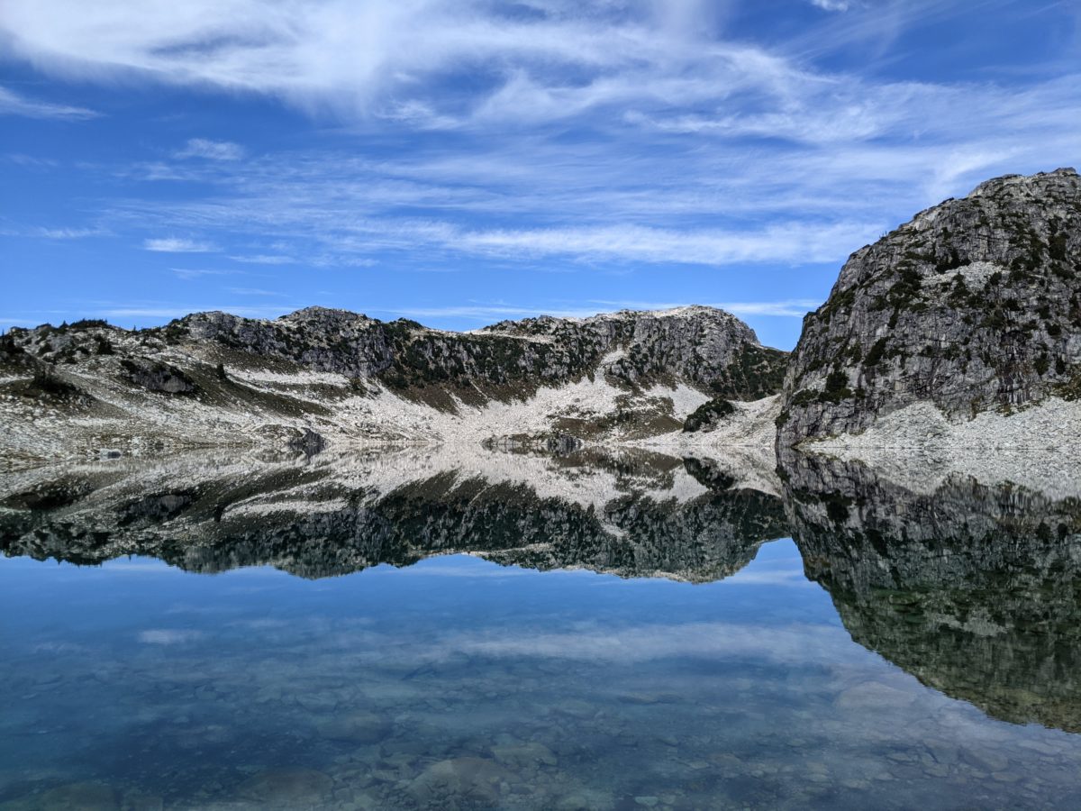
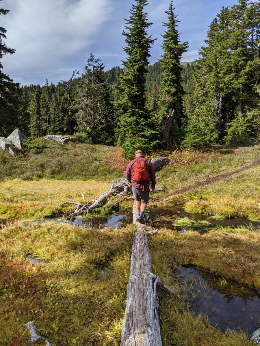
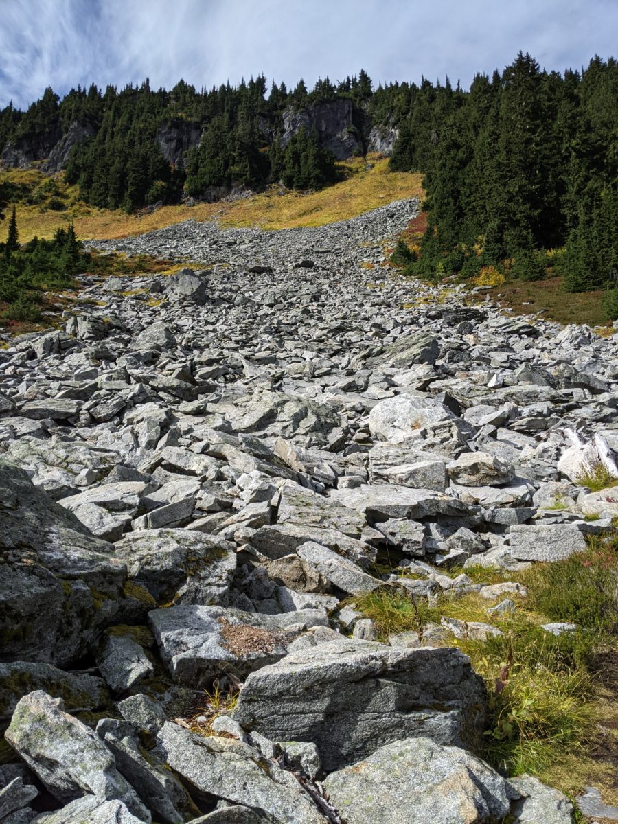
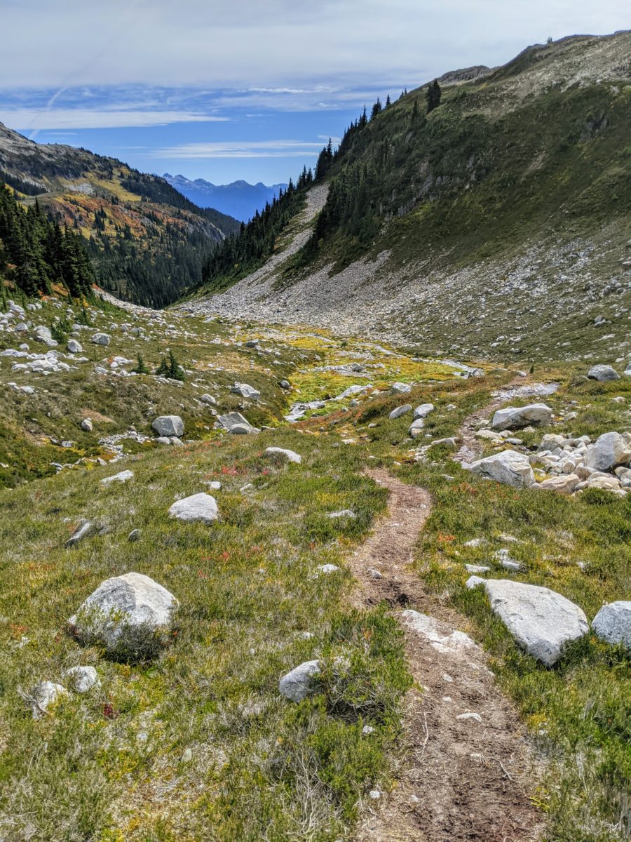
Blanca Lake is a small alpine lake accessed from a trailhead that starts at 1200m in elevation at the end of the E300 FSR and rises to ~1700m at the lake. The ~5km hike (one way) is moderately difficult (for British Columbia): fairly steep for the first forested kilometres before flattening out in the sub alpine half way, with a final push to the rocky lake summit for the last kilometre of the hike. There are a couple small (early fall weather small) creek crossings (1m wide) that require some boulder hopping or log balancing. The trail is mostly obvious but for a small section of boulders and a boggy creek-side area, but ravine sides and Blanca Peak in view keep you oriented.
This small Blanca Peak is just above the lake, which we didn’t attempt on this trip, but we’ve read it’s a straightforward rocky walk that shouldn’t add more than an hour or two return to the lake.
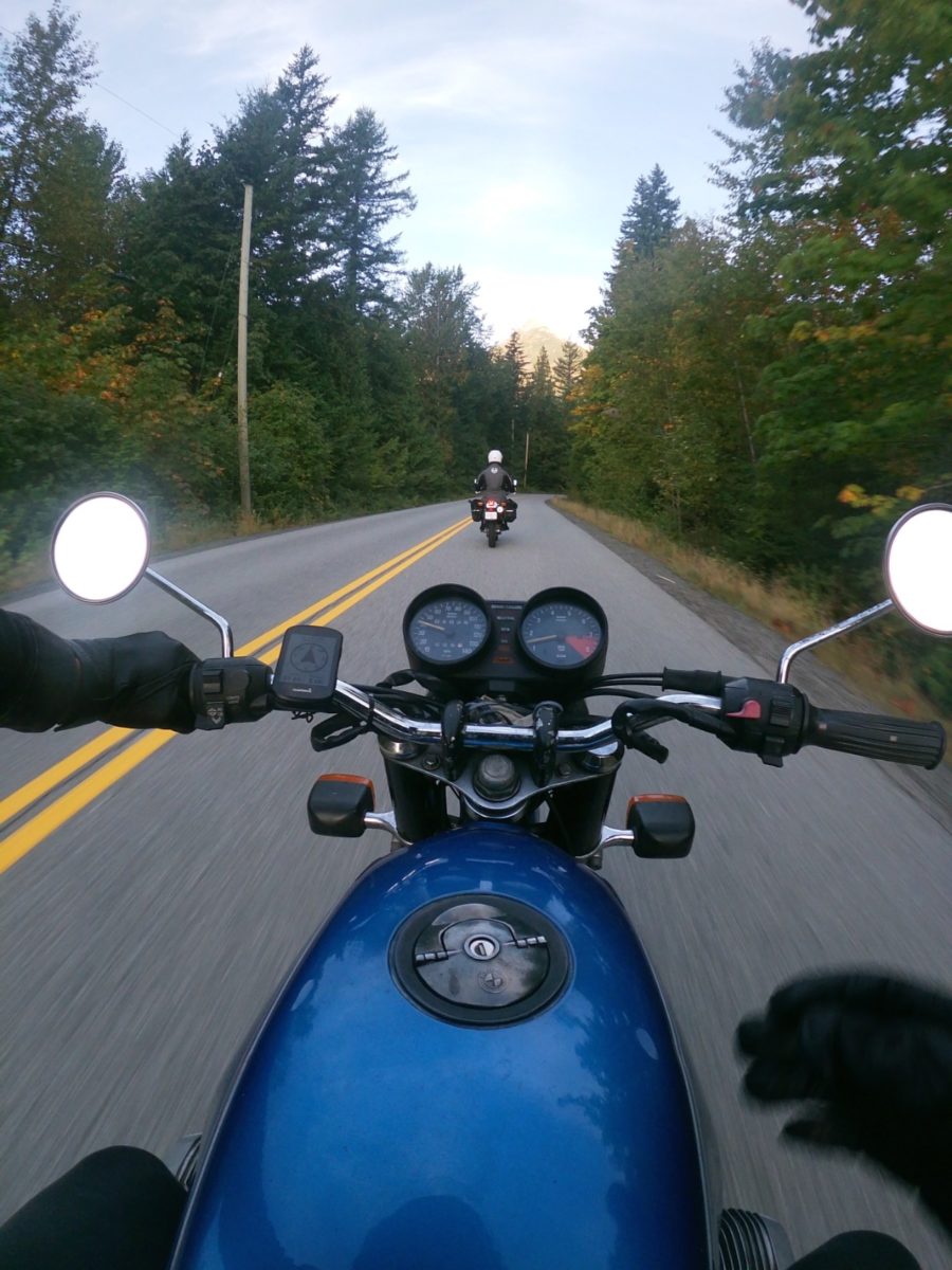
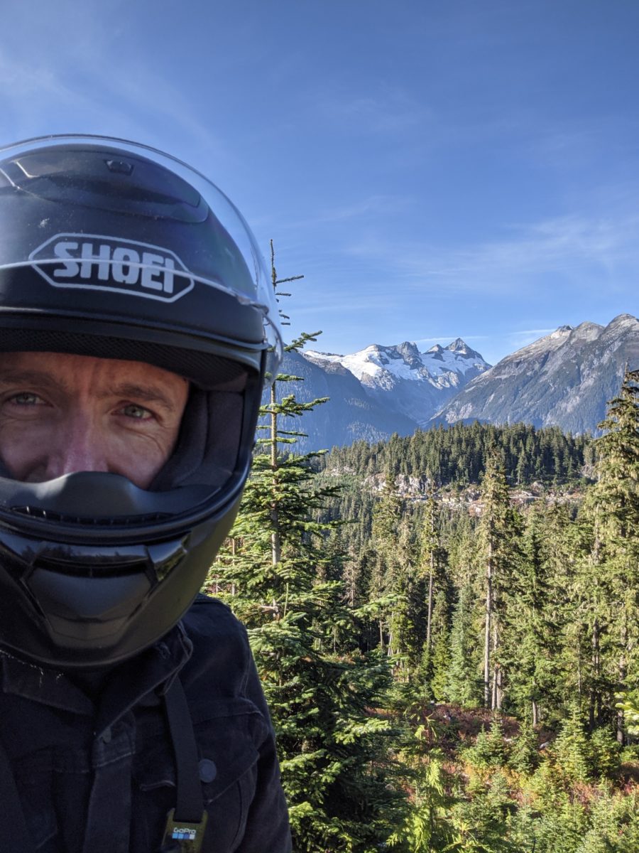
Having cancelled our Blanca plans last weekend due to rains—and snow above 1600m—my friend Mark noticed sunny window was predicted for Friday, September 24, so within 24hrs we had Googled and asked friends about the route—both the road and the hike—and set off from Squamish on our motorbikes at 7:15am with our daypacks, a couple lunches, the Gaia GPS app and a Back Road Map Book.
Road Route
All distance is taken with a Garmin Edge 530 GPS unit, from the Chevron gas station on Garibaldi Way in the large shopping area just north of downtown Squamish on Highway 99. From there we take the traffic-calmed Government Road for a couple kilometres before the T-intersection and left-turn on to Squamish Valley Road. We stay on this road, following the east bank of its namesake river, for the majority of the drive to the trailhead.
The first ~26km is gently curving smooth pavement, past small residential and farm home clusters, with the occasional view of freshly snow-capped valley peaks. There’s a clearly marked pull-off on a straightaway before the darkly forested dirt road begins. From here road condition is mostly wide, smooth, hard-packed gravel, though heavily potholed from the frequent recreation traffic: rafting buses to luxury SUVs, GS motorbikes to beat-up enduros, the ubiquitous tent-topped Tacoma trucks, and Honda Civics with teenagers partying along the river sandbars. We average about 50kph along this section.
At 27.5km we see the left turn and bridge to head up the Ashlu River—skip this and continue along the Squamish. 47km is the end of driving directions currently available on Google Maps, but the route is straight forward: stay on the main Squamish Valley road.
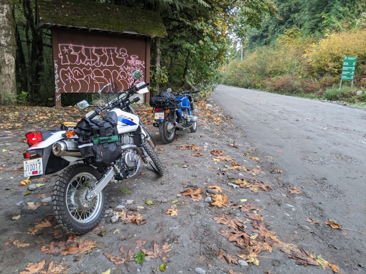
At 54.5km is the left turn and bridge up the Elaho River—head over this bridge. We’ve gained about 160m in elevation from Squamish (at sea level). Things start to go up quickly from here. At km 61 is the right turn onto the E300. There’s a large flat pull-out area, and we arrive just behind a Hummer and a Four Runner about to head up, and a parked white F350 truck.
The E300 is relatively smooth for most of its 10km length, making up most of its 900m elevation gain in steep (15%+ gradient) 300m sections before relaxing for a half a kilometre at 3–4% grades. Vehicle clearance is only an issue over its dozen+ water bars, some larger than others.
At ~1100m and 70km from Squamish—or about 9km up the E300 (or, as it turns out, 1km from the end and the start of the Blanca Lake trail)—is the currently roughest section of the road: a 200m-long right-turning switchback that’s loose and rutted and washed out (maybe because of the active logging just above). The Four Runner ahead of us made it half way before turning around and parking below, its occupants walking the section to hitch a lift with the Hummer truck that made it through.
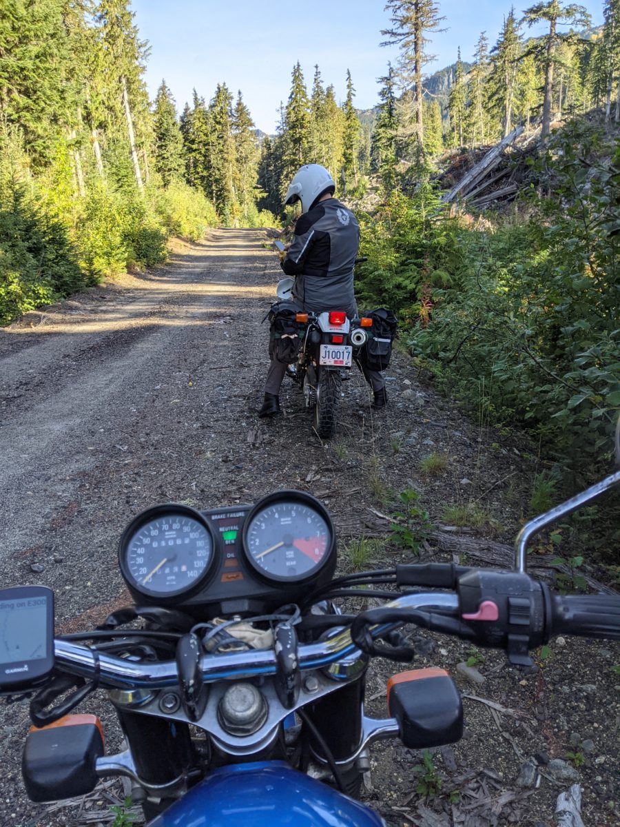
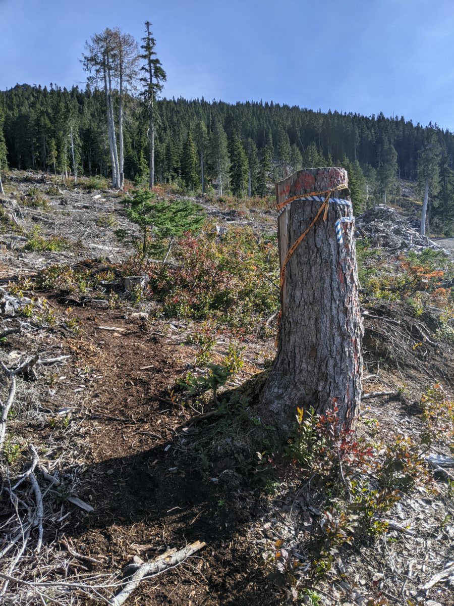
The trailhead is fairly obscured from the logging patch at the end of the E300. The end of the road is obvious, and we turned around keeping an eye peeled before we noticed, just a few hundred metres earlier, on the left uphill side of the road, is a metre-tall stump flagged with various ribbons. Easy to miss in the clearcut debris, but that’s the “new” start of the trail (I’m guessing this is a few hundred metres into the hike from the pre-logging, original trailhead start and existing GPX files out there).
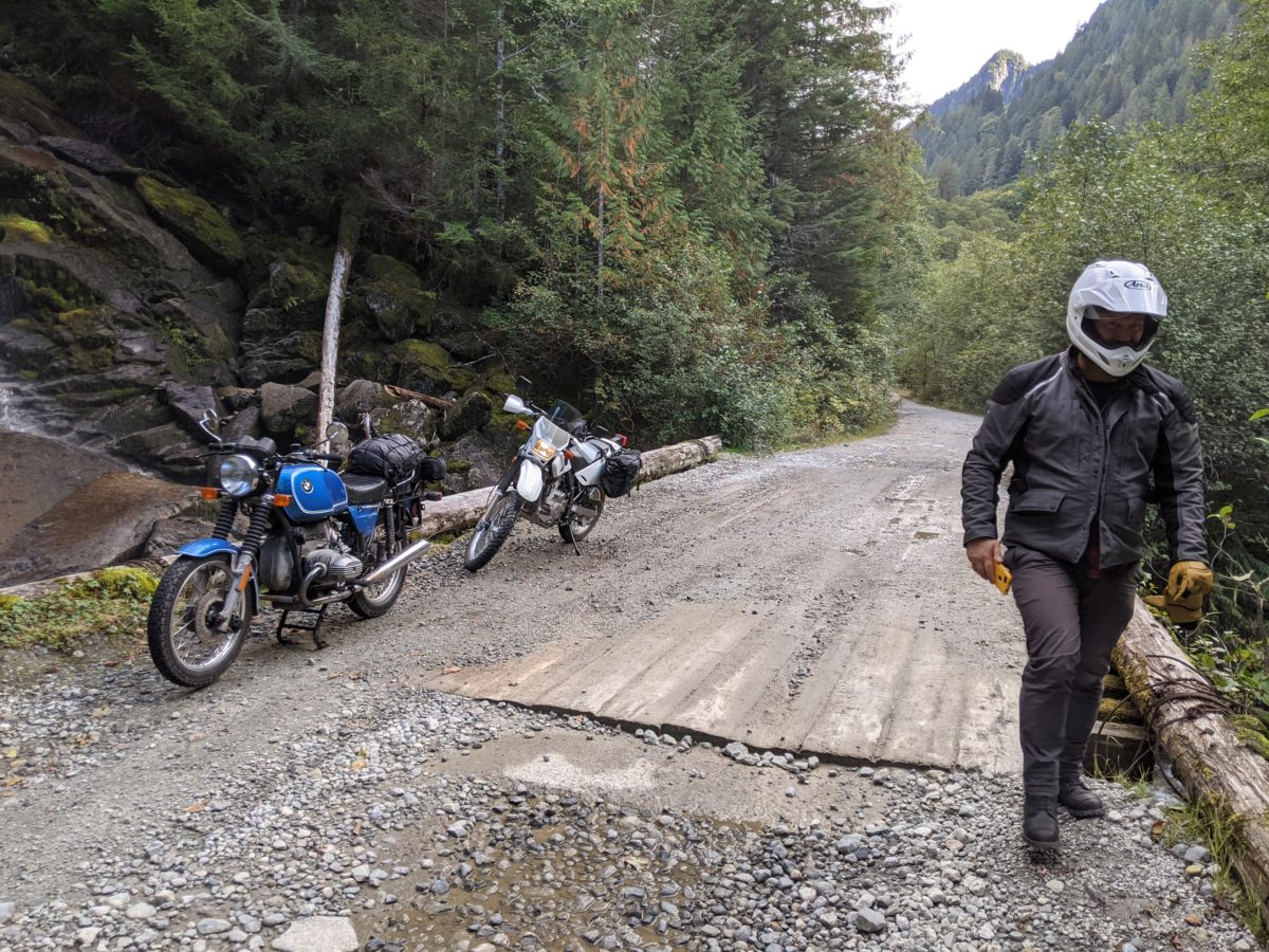
I was riding a stock 1977 BMW R75/7 street motorbike, which was surprisingly up to the task despite its lack of low gearing and high clearance. Lots of torque, though, and as long as I kept my speed up and chose the smoothest line I didn’t bog out and stall on the many steep pitches. My skills were at their limit, unsurprising as this was my second time motoing on a rough road. The tread on the Dunlop K70 retro revival tires I had on the motorbike could be a lot better, but I wouldn’t have made this section with regular street tires. I wouldn’t have made most of the E300 if the conditions were wet and muddy, though. There was one line through this last mess of the road and if I didn’t hit it I’d be walking it, if not abandoning the bike there—the former is what my equally beginner friend Mark had to do on his new Suzuki DR650 enduro motorbike, pushing it while feathering the clutch through the muck.
Descending the E300 on a 440lb motorbike turned out to be a lot more difficult that going up. Trying to keep control with engine braking and rear brake, but without stalling or sliding out, is a skill to be worked on, and required walking the bike (in some ways harder than riding) more than once before relaxing at the Elaho again).
Ran into a a hunter on the hike up to the lake, rifle at the ready because, after he calmed down and chatted with us, he came within a couple feet of a black bear at this very spot 2/3 the way up the trail when he was hiking in on Monday (five days ago). He had been (unsuccessfully) hunting mountain goats. It was his red ATV parked at the trailhead when we arrived. We asked how he was going to haul a kill out of the alpine with an already 50lb pack on, and he said he usually sends his teenage kids in after he gets home to schlep it out for him.
Never saw the Four Runner / Hummer guys again (they must have gone on to the peak). Met three women and a pre-teen hiking up on our way out after lunch.
Got back to Squamish for a pint at A-Frame with Alistair, one of our UVic crew from back in the day that had wanted to join us but was taking climbing lessons that day. This is after we bumped into Hector and Melissa rafting down the Squamish. We’ve spent years trying to organize a reunion excursion with these guys and the one day we give up and just Mark and I head out we bump into them.


Leave a Reply